
Study of Sewage Treatment Plant in Trivandrum Corporation Using Remote Sensing and GIS Techniques
Keywords:
sewage treatment plant, Thiruvananthapuram, RS and GISAbstract
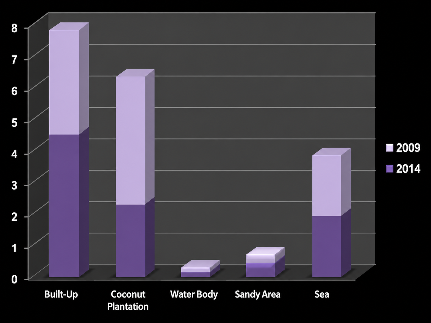
Sewage waste represents a threat to the environment and human health if not handled or disposed of properly. The present work aims to analyze the sewage network system of the sewage treatment plant of Thiruvananthapuram corporation situated at Muttathara, its functioning and land use pattern in the vicinity of 1.5 km around it using remote sensing and GIS techniques. Results of this study could aid in evolving relevant management strategies to improve the sewage water treatment management in Trivandrum Corporation.
References
[1] P. R. Kumar, L. B. Pinto and R. K. Somashekar (2010). Assessment of the Efficiency Of Sewage Treatment Plants: A comparative study between Nagasandra and Mailasandra Sewage Treatment Plants. Kathmandu Univ. J. Sci. Engi. Tech., 6: 115-125. http://www.nepjol.info/index.php/KUSET/article/view/4020.
[2] N. Muthukumaran and N. K. Ambujam (2003). Wastewater Treatment And Management In Urban Areas - A Case Study Of Tiruchirappalli City, Tamil Nadu, India” in Martin J. Bunch, V. Madha Suresh and T. Vasantha Kumaran, eds., Proceedings of the Third International Conference on Environment and Health, Chennai, India, 15-17 December, 2003. Chennai: Department of Geography, University of Madras and Faculty of Environmental Studies, York University. Pages 284-289. http://www.yorku.ca/bunchmj/ICEH/proceedings/Muthukumaran_N_ICEH_papers_284to289.pdf.
[3] B. Sundararaman, K. G. Vinothan, M. Lalwin (2012). Urban Hydrology - A Case Study On Water Supply And Sewage Network For Madurai Region, Using Remote Sensing & GIS Techniques. Int. J. Eng. Sci., 1: 7-12. http://www.researchinventy.com/papers/v1i8/B01807012.pdf.
[4] S. Sengupta and P. Venkatachalam (2001). Assessment of Pressure on Land in an Urban Area Using Remote Sensing and GIS, A. P. , in Srinivas, M.G. (ed.) Remote Sensing Applications, New Delhi, Narosa Publishing House
[5] M. Palaniyandi and V. Nagarathinam (1997). Land use/land cover mapping and change detection using space born data. J. Indian Soc. Remote, 25: 27-33
[6] K. S. R. Murthy and R. V. Venkateswar (1997). Temporal studies of land use/land cover in Varah river basin, Andhra Pradesh. J. Indian Soc. Remote, 25: 153-154.
[7] E. Abumohar (2010). Domestic waste water treatment and its reuse of irrigating home gardens (A case study). http://www.arij.org/files/admin/2012/Domestic%20Wastewater%20Treatment%20and%20Its%20Reuse%20for%20Irrigating%20Home%20Gardens%20Case%20Study.pdf.
Downloads
Published
Issue
Section
License
Copyright (c) 2016 Author (s)

This work is licensed under a Creative Commons Attribution-NonCommercial-NoDerivatives 4.0 International License.
Copyright © The Author(s). This is an open access article distributed under the terms of the Creative Commons Attribution-NonCommercial-NoDerivatives 4.0 International License (CC BY-NC-ND 4.0), which permits unrestricted non-commercial use, distribution, and reproduction in any medium, provided the original author(s) and source are properly credited, and the work is not modified or adapted.