
Assessment of Temporal Changes in Land use Pattern over the Kinfra-Vizhinjam Stretch in Thiruvananthapuram City
Keywords:
change detection, vegetation vigor, unsupervised classification, urban landscapeAbstract
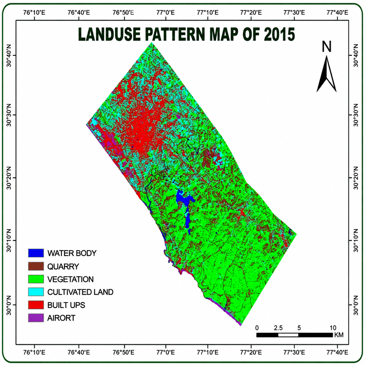
Metropolitanization is one of the main causes behind the transformations of the coastal segments of Kerala, where new urban settlements have evolved during last decades. Depending on the monetary and administrative roles, various cities speedily changed to territorial junctions. Urbanization causes land use/land cover changes which can lead to deeper social, economic and environmental changes. Remote sensing technology has great potential for acquisition of detailed and accurate land use information for management and planning of urban regions. Our study area was located between 80 22’ 45’’ North latitude to 760 59’ 29’’ East longitude (Vizhinjam) and 120 6’ 77’’ North latitude to 750 24’ 38’’ East longitude (Kinfra). The main objective of the study was to assess the temporal changes in the landscape spatial pattern to define the growth trends in the area and moreover, to evolve a land use map constructed according to the unsupervised classification technique.
References
[1] R. K. Verma, S. Kumari and R. K. Tiwary (2008). Application of Remote Sensing and GIS Technique for Efficient Urban Planning in India. http://www.csre.iitb.ac.in/~csre/conf/wp-content/uploads/fullpapers/OS4/OS4_13.pdf
[2] R. Suja, J. Letha and J. Varghese (2013). Evaluation of Urban growth and expansion using Remote sensing and GIS. IJERT., 2: 2772-2779.
[3] P. Saravanan and P. Ilangovan (2010). Identification of Urban Sprawl Pattern for Madurai Region Using GIS. Int. J. Geomatics and Geosciences, 1: 141-149.
[4] J. S. Rawat, V. Biswas and M. Kumar (2013). Changes in land use/cover using geospatial techniques: A case study of Ramnagar town area, district Nainital, Uttarakhand, India. EJRS., 16: 111-117.
[5] J. Xiao, Y. Shen, J. Ge, R. Tateishi, C. Tang, Y. Liang and Z. Huang (2006). Evaluating urban expansion and land use change in Shijiazhuang, China, by using GIS and remote sensing. Landscape Urban Plan., 75: 69-80.
[6] P. Singh and S. Singh (2011). Land use Pattern Analysis Using Remote Sensing: A Case Study of Mau District, India”, Archives of Applied Science Research, 3: 10-16.
Downloads
Published
Issue
Section
License
Copyright (c) 2016 Author (s)

This work is licensed under a Creative Commons Attribution-NonCommercial-NoDerivatives 4.0 International License.
Copyright © The Author(s). This is an open access article distributed under the terms of the Creative Commons Attribution-NonCommercial-NoDerivatives 4.0 International License (CC BY-NC-ND 4.0), which permits unrestricted non-commercial use, distribution, and reproduction in any medium, provided the original author(s) and source are properly credited, and the work is not modified or adapted.