
Land Use Change Analysis of Neyyar Wildlife Sanctuary, Kerala Using GIS and Remote Sensing Methods
Keywords:
change detection technique, GIS, India, land use change, remote sensing, unsupervised classificationAbstract
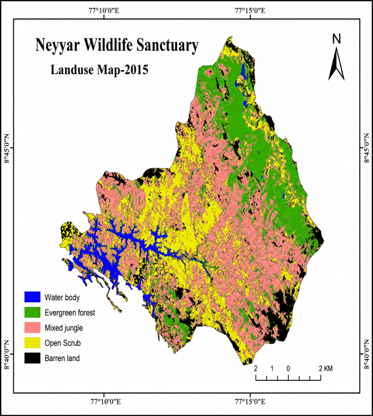
The Western Ghats is one of the world's 18 hotspots of biodiversity and forest communities that have a vital role in maintaining a balanced eco-system of the world. The Neyyar Wildlife Sanctuary located on the Western slopes of the Western Ghats along the South East corner of Kerala in India was selected as the study area owing to its diversified wealth of floral characteristics specifically at the landscape level. The present study was carried out using an integrated approach employing Remote Sensing and GIS techniques for land cover change analysis. The aim of the study was to quantify and map forest cover change in term of land use change during 2001-2015. Land sat 8 images (8 bands), Survey of India toposheets and Google earth images were used for visual interpretation of the land cover classes. The most notable land use categories obtained were evergreen forest, water body, mixed jungle, scrub land and barren land/rocky areas. The study revealed that there is a net decrease in the forest cover during 2001 to 2015.
References
[1] W. F. Ruddiman (2003). The anthropogenic greenhouse era began thousands of years ago. Clim. Chang., 61: 261-293.
[2] L. Chen, J. Wang, B. Fu and Y. Qiu (2001). Land-use change in a small catchment of northern Loess Plateau, China. Agric. Ecosyst. Environ., 86: 163-172.
[3] T. Lillesand, R. W. Kiefer and J. Chipman (1999). Remote Sensing and Image Interpretation. (New York: John Wiley & Sons).
[4] R. A. Houghton and G. M. Woodwell (1981). Biotic contributions to the global carbon cycle: the role of remote sensing. In Proceeding of the Seventh International Symposium on Machine Processing of Remote Sensing Data, Indiana, USA, pp: 593-602.
[5] D. B. Botkin, J. E. Estes, R. M. McDonald, and M. V. Wilson (1984). Studying the Earth’s vegetation from space. Bioscience, 34: 508-514.
[6] J. P. Malingreau (1991). Remote sensing for tropical forest monitoring: an overview. In Remote Sensing and Geographic Information Systems for Resource Management in developing countries, pp: 253-278.
[7] J. R. Anderson, E. E. Hardy, J. T. Roach, R. E. Witmer (1976). A land use and land cover classification system for use with remote sensor data”, US Geological Survey Professional Paper No. 964, Washington, DC.
[8] S. Menon and K. S. Bawa (1997). Applications of geographic information systems, remote sensing, and a landscape ecology approach to biodiversity conservation in the Western Ghats. Current Sci., 73: 134-145.
[9] C. S. Jha, C. B. S. Dutt and K. S. Bawa (2000). Deforestation and land use changes in Western Ghats, India. Current Sci., 79: 231-238.
Downloads
Published
Issue
Section
License
Copyright (c) 2016 Author (s)

This work is licensed under a Creative Commons Attribution-NonCommercial-NoDerivatives 4.0 International License.
Copyright © The Author(s). This is an open access article distributed under the terms of the Creative Commons Attribution-NonCommercial-NoDerivatives 4.0 International License (CC BY-NC-ND 4.0), which permits unrestricted non-commercial use, distribution, and reproduction in any medium, provided the original author(s) and source are properly credited, and the work is not modified or adapted.